If there was a lesson to be learned from last year���߲��о����s flooding in the Okanagan���߲��о����at least when it comes to the level of Okanagan Lake���߲��о����it���߲��о����s that anything can happen, says Shaun Reimer.
Reimer, the section head for public safety and protection at the Ministry of Forest, Lands, Natural Resource Protection and Rural Development, is the person in charge of releasing water from Okanagan Lake in order to moderate its level.
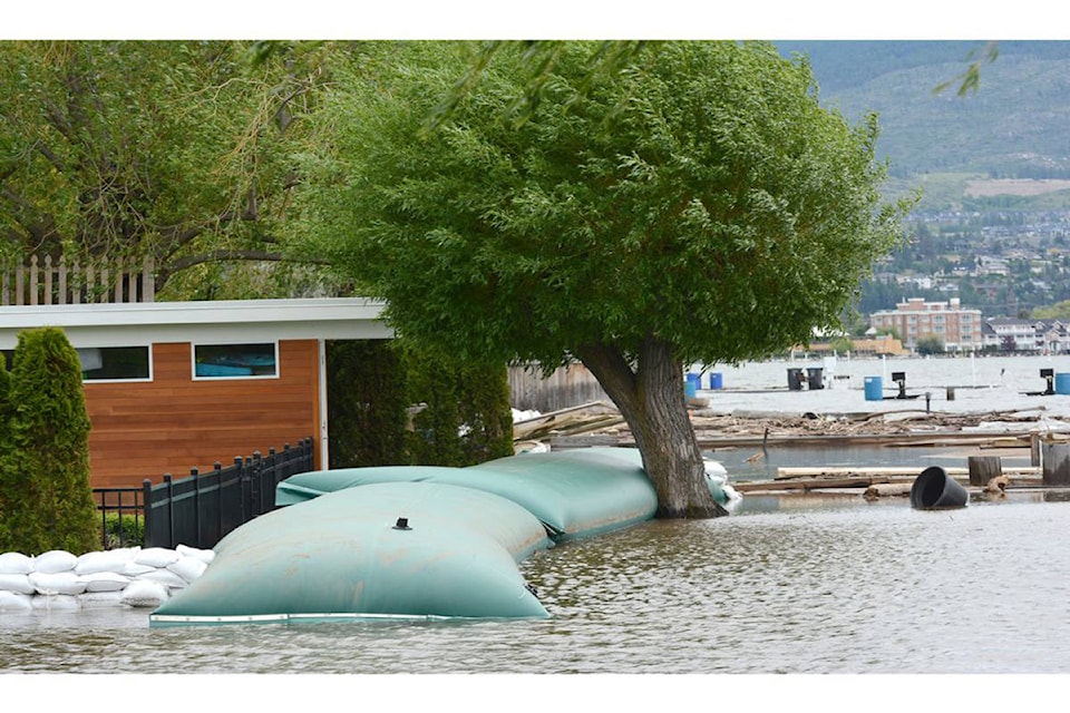
Feature Friday: Climate change impacts Okanagan Lake
Last year, after snow in the mountains melted quickly due to unseasonably warm weather in the spring, and aided by heavy rains, area creeks first overflowed their banks and then sent a historically high torrent of water flowing into Okanagan Lake, driving its level up to historic highs.
With the amount of water that could be safely released from the lake at its south end into the Penticton River channel limited, several areas along the lakeshore saw flooding in the areas of the north, central and south Okanagan experienced flooding.
���߲��о����Last year was so strange,���߲��о���� said Reimer. ���߲��о����It was so outside the box.���߲��о����
While it���߲��о����s still early, Reimer said he is keeping an eye on the snowpack levels in the mountains but admitted it is hard to plan for the spring because it���߲��о����s not clear yet what Mother Nature may throw at this area in March and April.
Related: High snowpack for the Okanagan
Related: Special avalanche warning issued for B.C. Interior
He said in previous years, when there has been an above-average snowpack in the mountains and the weather has cooperated, the flow of water down creeks and into the lake has been manageable and there has been no flooding. But last year, when the snow pack was at just 79 per cent of average in January and 80 per cent of average in February, the heavy rain and warm weather in early March created widespread flooding.
Currently, according to the B.C. River Forecast Centre, the snowpack in mountains above the Okanagan is around 20 per cent higher than average. Normally, this area sees about half its snowpack total by this time of the year.
Reimer said at this point, it���߲��о����s a ���߲��о����wait-and-see���߲��о���� situation when it comes to figuring out how to deal with a possible repeat of last spring���߲��о����s flooding. With a clearer picture emerging in February, he will start to look at possible lake level targets for the spring.
Over the winter, he said, the lake level can���߲��о����t go down any more than 15 to 20 centimetres below the target level in order to protect fish spawning areas. Currently it is about five centimetres below the target.
To report a typo, email: edit@kelownacapnews.com.
<>
awaters@kelownacapnews.com
Like us on and follow us on .


