UPDATE: Friday, May 5, 8:30 a.m.
The storm warning has been lifted and the forecast has become a lot more mild.
There will be showers ending late this evening then the forecast calls for cloudy skies with 60 per cent chance of showers. Saturday will be mainly cloudy with 40 per cent chance of showers, and a high temperature of 15 C.
UPDATE: Friday, May 5, 7:30 a.m.
If you enjoyed last night���߲��о����s storm you might be in luck.
Environment Canada has issued a storm watch alert that spans the Okanagan valley.
���߲��о����Conditions are favourable for the developemnt of severe thunderstorms that may be capable of producing strong wind gusts, large hail and heavy rain,���߲��о���� reads the statement from the national weather agency.
The government agency also laid out the risks of such weather.
Large hail, they advise, can damage property and cause injury. Heavy downpours can cause flash floods and water pooling on roads.
���߲��о����Lightning kills and injures Canadians every year,���߲��о���� reads the statement. ���߲��о����Remember, when thunder roars, go indoors.���߲��о����
UPDATE:
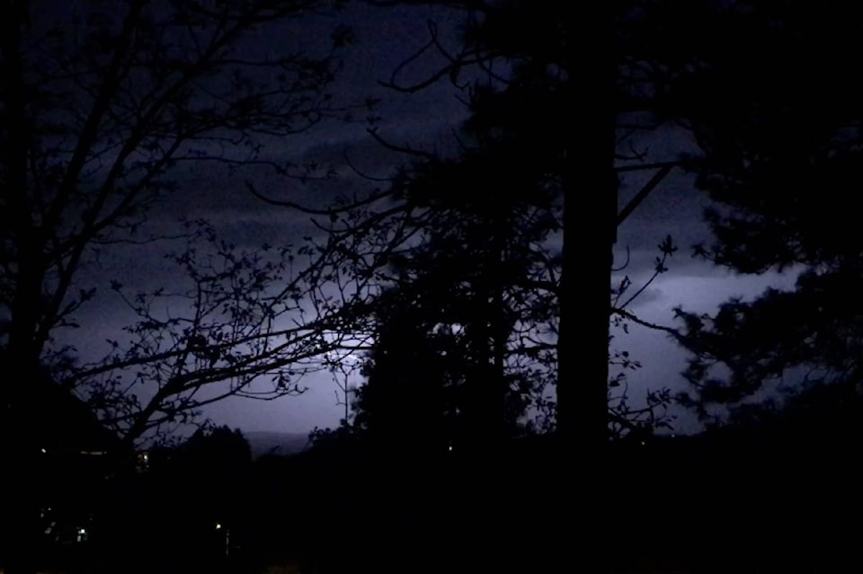
Thunder and lightning is moving up the valley as heavy rains and wind hit the region.
Reports of sheet lightning and large fork lightning are coming in.
Power has also flickered on and off in the Valley.
A ���߲��о����Special weather statement���߲��о���� issued by Environment Canada is still in effect for the Shuswap and entire Okanagan Valley.
Meteorologists say to expect thunderstorms with heavy downpours.
���߲��о����A Pacific cold front will approach the BC coast this evening. Ahead of the front, conditions will be favourable for thunderstorm development over the southwestern interior of BC tonight,���߲��о���� writes Environment Canada.
���߲��о����Heavy rain associated with the thunderstorms combined with spring snow melt will lead to rising river levels and may increase the risk of flooding.
���߲��о����Fast flowing water and adjacent riverbanks will be potentially unsafe.���߲��о����
The is issuing high streamflow advisories for streams and rivers South Interior, Central Interior and South-East regions of the province.
Almost 700 lightning strikes from 21:30-22:30 PDT. Over 1000 if you include the rest of the t-storm line south of the border.
���߲��о���� ECCC Weather BC (@ECCCWeatherBC)
Send your weather photos to us to display online, by clicking Contact at the top of the Home Page and following the direction.
���߲��о����-
ORIGINAL:
A special weather statement is in effect for the entire Okanagan Valley. A Pacific cold front approaching the B.C. coast could possibly bring heavy downpours, Thursday night.
According to Environment Canada, conditions will be favourable for thunderstorm development over the southwestern interior of B.C. tonight.
Heavy rain combined with spring snow melt may lead to rising river levels and increase flood risk.
The is issuing high streamflow advisories for streams and rivers South Interior, Central Interior and South-East regions of the province.
Send your weather photos to us to display online, by clicking Contact at the top of the Home Page and following the direction.


