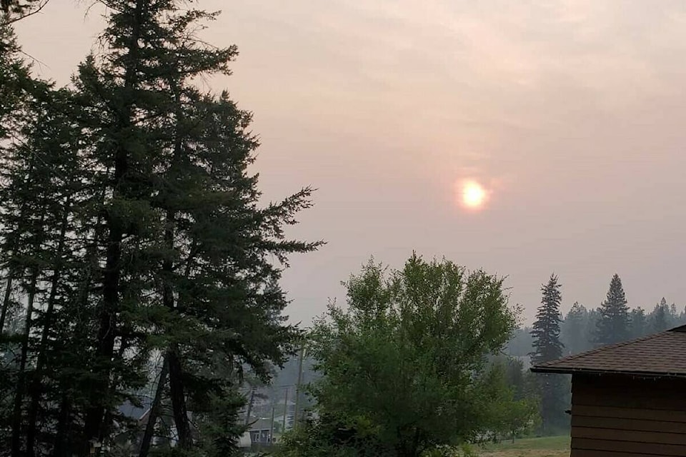
Smoke has settled into a number of communities across the province, prompting a health advisory.
The Ministry of Environment and Climate Change Strategy issued the air quality advisory Monday, July 22.
"Significant improvements are expected in smoke concentrations over the next 24 hours as westerly winds move across the province moving smoke east," the bulletin reads. "Expect smoke to linger in valleys and near to active fires."
During a wildfire, smoke conditions can change quickly over short distances and can vary considerably hour-by-hour.
"Wildfire smoke is a natural part of our environment but it is important to be mindful that exposure to smoke may affect your health," the ministry advises.
People with pre-existing health conditions, respiratory infections such as COVID-19, older adults, pregnant women and infants, children, and sensitive individuals are more likely to experience health effects from smoke exposure.
The following tips are offered during smoky conditions:
���߲��о���� Follow your common sense.
���߲��о���� Stop or reduce your activity level if breathing becomes uncomfortable or you feel unwell.
���߲��о���� Stay cool and drink plenty of fluids.
���߲��о���� If you have asthma or other chronic illness, carry any rescue (fast-acting) medications with you at all times and activate your personal care plan that has been designed with your family physician.
���߲��о���� Make sure that children and others who cannot care for themselves follow the same advice.
People respond differently to smoke and mild irritation and discomfort are common, and usually disappear when the smoke clears.
If you are unsure whether you need medical care, call HealthLink BC at 8-1-1.
If you are experiencing difficulty in breathing, chest pain or discomfort, or a severe cough, contact your health care provider, walk-in clinic, or emergency department. If you are having a medical emergency, call 9-1-1.
Tips to reduce your smoke exposure:
���߲��о���� Smoke levels may be lower indoors but will still be elevated, so stay aware of your symptoms even when you are indoors.
���߲��о���� Running a commercially available HEPA (high efficiency particulate air) filter can improve indoor air quality in the room where the device is located.
���߲��о���� If you have a forced air heating/cooling system in your home, it may help to change the filter and set the fan to run continuously.
���߲��о���� Reduce indoor air pollution sources such as smoking, burning incense, and frying foods.
���߲��о���� Consider going to a library, community centre, or shopping mall with cooler filtered air to get some relief from the smoke.
���߲��о���� If travelling in a car with air conditioning, keep the windows up and the ventilation set to recirculate.
���߲��о���� If you are very sensitive to smoke, consider moving to another location with cleaner air, but be aware that conditions can change rapidly.
���߲��о���� Maintaining good overall health is a good way to prevent health effects resulting from short-term exposure to air pollution.
Regions included are:
���߲��о���� 100 Mile - Highway 97 from 108 Mile House to Clinton, Bridge Lake and Canim Lake
���߲��о���� Arrow Lakes-Slocan Lake - includes Slocan, New Denver, Nakusp, and Fauquier B.C.
���߲��о���� North Peace River - includes the City of Fort St John and all communities along Hwy 97 extending from Farmington to Pink Mountain; Hwy 29 including Moberly Lake, Hudson���߲��о����s Hope; also includes Rolla, Clayhurst and Goodlow B.C.
���߲��о���� South Peace River - includes Chetwynd, Dawson Creek, Pouce Coupe, and Tumbler Ridge Boundary includes Grand Forks, Midway and Greenwood
���߲��о���� Cariboo (North) - includes Quesnel, Wells and Bowron Lake Park
���߲��о���� Cariboo (South) - includes Williams Lake, Northern and Central sections of Wells Gray Park
���߲��о���� Central Okanagan - includes Kelowna, Lake Country, West Kelowna and Peachland
���߲��о���� East Columbia - includes Golden
���߲��о���� East Kootenay (North) - includes Edgwater, Inveremere, Canal Flats and Skookumchuck
���߲��о���� East Kootenay (South) - includes Kimberley, Cranbrook, Yahk, Moyie, Wasa Lake Provinical Park, Jaffray, Grasmere and Roosville
���߲��о���� Elk Valley - includes Elko, Fernie, Sparwood and Elkford
���߲��о���� Fort Nelson - includes Fort Nelson, Muskwa, Prophet River, Buckinghorse River, Sikanni Chief, Hwy 77 north to the Yukon border
���߲��о���� Kinbasket - includes Kinbasket reservoir south of Valemount
���߲��о���� Kootenay Lake - includes Creston and Kaslo
���߲��о���� McGregor - includes the northern end of the Robson Valley extending from Hansard to Dome Creek; extends north to Monkmon Park
���߲��о���� North Columbia - includes Blue River and McMurphy
���߲��о���� North Okanagan - includes Vernon, Armstrong, Enderby, Lavington and Lumby
���߲��о���� North Thompson - includes Barriere, Clearwater and Vavenby
���߲��о���� Prince George - includes the City of Prince George, Hwy 16 Bednesti to Upper Fraser, and Page 5 of 6 Hwy 97 Hixon to the south end of McLeod Lake
���߲��о���� Shuswap - includes Salmon Arm, Sicamous, and Chase
���߲��о���� South Okanagan - includes Penticton, Summerland, Naramata, Keremeos, Oliver and Osoyoos
���߲��о���� South Thompson - includes Kamloops, Rayleigh, Monte Creek, Cache Creek, Spences Bridge and Logan Lake
���߲��о���� Stuart - Nechako includes Fraser Lake, Fort Fraser, Vanderhoof, Fort St James, and Tachie
���߲��о���� West Columbia - includes Revelstoke
���߲��о���� West Kootenay - includes Nelson, Castlegar, Trail, Rossland
���߲��о���� Williston - includes McLeod Lake, Mackenzie and Williston Lake
���߲��о���� Yellowhead - includes McBride and Valemount and all communities within the southern half of the Robson Valley extending from Urling to Valemount and the northern half of Mount Robson Park
���߲��о���� Yoho-Kootenay Park - includes Yoho and Kootenay National Parks


